 +55-11-3280-2197
 +1-305-851-7982
 +44-020-8144-4939


Rio de Janeiro
Av. Presidente Wilson, 231 / Salão 902 Parte - Centro
CEP 20030-021 - Rio de Janeiro - RJ
+55 21 3942-1026
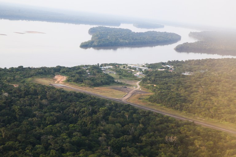
Mapping of land in the Amazon
So far, TerraClass has already generated data for the period from 2004 to 2014
A Federal Government project that provides data on the mapping of land use and coverage in the Amazon, TerraClass should be resumed in the first half of this year. The program was paralyzed for some time, but, through an articulation between the Brazilian Agricultural Research Corporation (Embrapa) and the Management and Operational Center of the Amazon Protection System (Censipam), resources were secured for the return of activities. Embrapa is the institution responsible for implementing the initiative.
So far, TerraClass has already generated data on land cover and land use in the Amazon for the period from 2004 to 2014. The information is always updated every two years. According to Embrapa, in 2021, data from 2020 will be delivered. In 2022, the years 2018 and 2021 will be presented. And, in 2023, the expectation is to normalize the process with the delivery of data from 2022.
What is TerraClass
In operation since 2010, the TerraClass project makes a detailed mapping of the different types of land use in the Amazon, investigates the reasons and points out the possible causes of deforestation in the region. All of this based on data generated by the National Institute for Space Research (Inpe) through the project Prodes - Monitoring the Brazilian Amazon Forest by Satellite.
Prodes maps deforested areas, and TerraClass discovers the reasons behind the cutting down of trees.
Based on remote sensing and geoprocessing techniques, the professionals involved seek information on the dynamics of deforestation and, with this, produce systemic maps of use and coverage of deforested lands in the Legal Amazon.
TerraClass monitors, for example, the dynamics of secondary vegetation, which grows after the suppression of primary vegetation, and which has never been accounted for. Secondary vegetation (also known as capoeira) is extremely important to measure emissions or carbon sequestration into the atmosphere and to respond to global climate issues.
Public policy
The results of TerraClass are used at various levels for planning sustainable development in the Amazon and also to answer international questions about occupation in the region. The states of the Amazon use the data generated in the Ecological-Economic Zoning projects, in the definition of areas of permanent preservation and alternative use.
Right now, for example, Embrapa is in negotiations with the National Institute of Colonization and Agrarian Reform (Incra) so that the data can be used in the validation of the Rural Environmental Registry, which is why the work of updating the historical series is so important.
GeoPortal TerraClass
Any citizen who wants to have access to the data and maps generated by TerraClass can access GeoPortal TerraClass, a free and online tool for consulting and analyzing maps in real time. Geospatial data allows anyone to better understand the dynamics of land use and coverage in the Legal Amazon.
Before the launch of GeoPortal, all of this data and information was already on the internet for public consultation. However, all the material was accessible only in raw form, which required previous work on computational processing and the use of geographic information systems to then proceed to specific analyzes. GeoPortal makes data accessible and simple. In addition, researchers have incorporated several visualization and analysis tools that generate tables and graphs, facilitating analysis.
 Mr. Alessandro Jacob speaking about Brazilian Law on "International Bar Association" conference
 Av. Presidente Wilson, 231 / Salão 902 Parte - Centro
CEP 20030-021 - Rio de Janeiro - RJ
+55 21 3942-1026
Travessa Dona Paula, 13 - Higienópolis
CEP -01239-050 - São Paulo - SP
+ 55 11 3280-2197